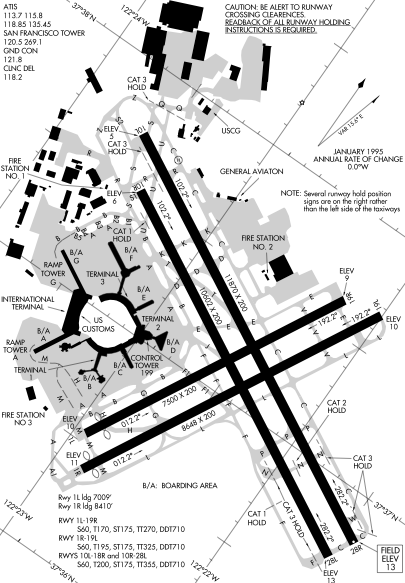
קובץ:SFO map.png
מראה
SFO_map.png (405 × 583 פיקסלים, גודל הקובץ: 57 ק"ב, סוג MIME: image/png)
היסטוריית הקובץ
ניתן ללחוץ על תאריך/שעה כדי לראות את הקובץ כפי שנראה באותו זמן.
| תאריך/שעה | תמונה ממוזערת | ממדים | משתמש | הערה | |
|---|---|---|---|---|---|
| נוכחית | 02:14, 17 בדצמבר 2005 |  | 583 × 405 (57 ק"ב) | Sam916~commonswiki | ==Summary== Detail from FAA diagram of San Francisco International Airport. Warning, this diagram contains material which is subject to change, do not use for navigation. ==Licensing== {{PD-USGov-FAA}} |
שימוש בקובץ
הדף הבא משתמש בקובץ הזה:
שימוש גלובלי בקובץ
אתרי הוויקי השונים הבאים משתמשים בקובץ זה:
- שימוש באתר ca.wikipedia.org
- שימוש באתר de.wikipedia.org
- שימוש באתר fr.wikipedia.org
- שימוש באתר id.wikipedia.org
- שימוש באתר ja.wikipedia.org
- שימוש באתר mr.wikipedia.org
- שימוש באתר ms.wikipedia.org
- שימוש באתר ta.wikipedia.org
- שימוש באתר th.wikipedia.org
- שימוש באתר vi.wikipedia.org


